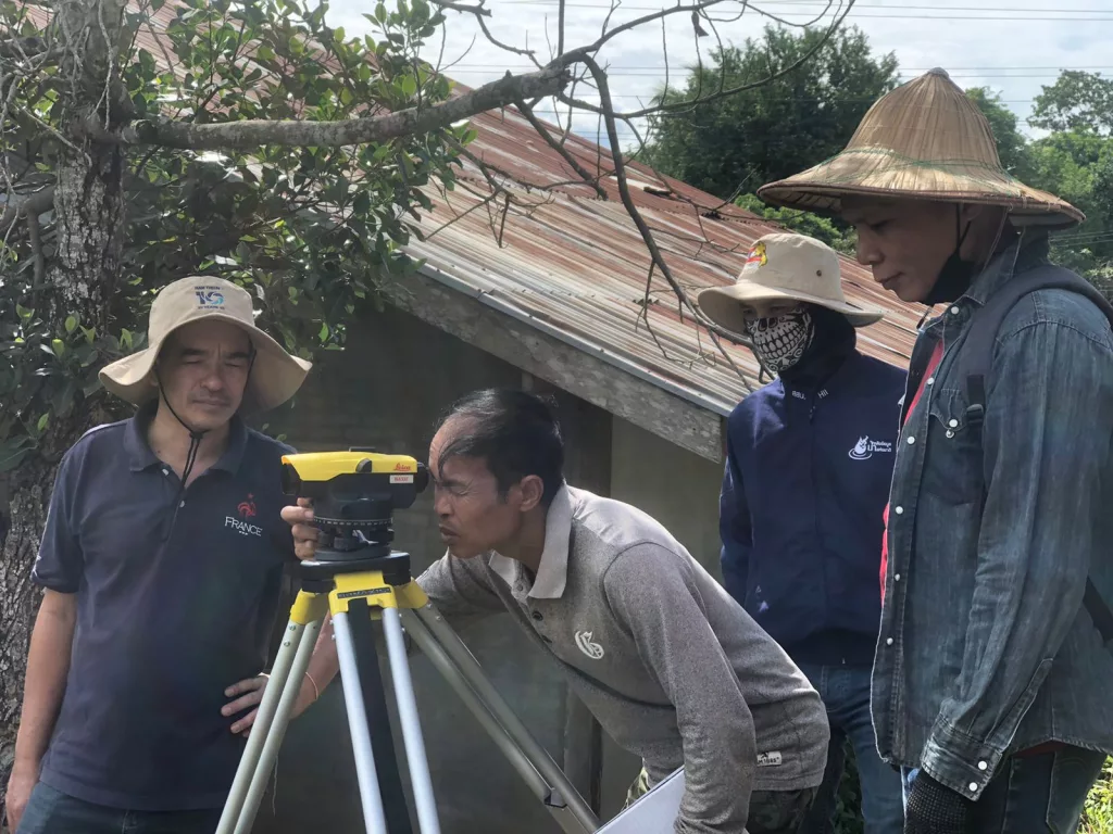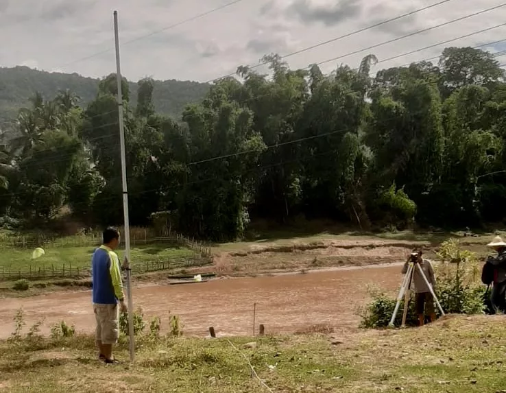
Field measurement that will allow the estimation of river flows in three pilot basins in Cambodia and Laos have recently begun. In these two countries, CIMA Research Foundation is working to strengthen climate resilience under a project part of the CREWS Initiative
It is well known that climate change can have a profound influence on some hydrometeorological phenomena, such as floods and droughts. For some particularly vulnerable regions of the world, being able to prevent their impacts is now a fundamental necessity. This means strengthening climate resilience by working on mechanisms for forecasting, preventing and responding to environmental disasters.
It is with this in mind that the CREWS Initiative, a partnership pursued by WMO, World Bank, Global Facility for Disaster Reduction and Recovery (GFDRR) and UNDRR, focuses on the most fragile and disaster-vulnerable island states. Within the initiative, just recently activities have begun to estimate the flow rates of six river basins in Cambodia and Laos. This work has as the goal to create of an impact-based hydrometeorological forecasting chain, that is, one that can indicate the possible impacts on the population and economy of the region.
The project in Cambodia and Laos
Among the projects carried out by the CREWS Initiative, one is specifically targeting Cambodia and Laos. Among those known as the Lower Mekong countries (which also include Thailand, Vietnam, and Burma), these two states have been found to be among the most vulnerable to disasters: typhoons, floods, and droughts have in fact done serious damage in recent years. An example is the collapse of Saddle Dam D in Laos in 2018, the effects of which spread also to Cambodia.
The vulnerability is exacerbated by the fact that, in both Cambodia and Laos, some climate-sensitive economic sectors play a key role in the economy: agriculture, for example, employs most of their workforce.
Early Warning Systems (EWSs), combined with accurate forecasting capabilities and effective response mechanisms, are therefore an important element in managing hydro-meteorological hazards and ultimately building the resilience of regions. This is why they also represent the focus of the CREWS Initiative project Reinforcing the capacities of meteorological and hydrological services and enhancing the early warning systems in Cambodia and Lao People’s Democratic Republic (PDR), in which CIMA Research Foundation participates on behalf of WMO. We have three goals: to produce risk scenarios for floods and droughts; to nationally implement the myDEWETRA.world platform (a forecasting and monitoring system to support risk management); and to develop impact-based forecasts in six pilot basins, to facilitate the identification of areas and sectors on which to focus forecasting and response efforts to a flood event.
The recently begun activities are focused on this latter goal and they will be continued throughout the summer. “The system we are setting up is similar to the one we have now almost completely implemented in the Horn of Africa,” says Lorenzo Alfieri, researcher in the Hydrology and Hydraulics Department of CIMA Research Foundation. “It is a forecasting chain that starts with meteorological data, feeding them into the Continuum hydrological model. This, in turn, simulates flood phenomena that may occur and links them to flood scenarios. The last step in the chain is the estimation of the possible impacts in the area of interest: the damage to the population, including possible displacements; the losses of cropland (in terms of hectares) and number of livestock and grazing area; the kilometers of roads damaged; and finally the loss of gross domestic product.”
The whole process takes place within the Flood PROOFS forecasting chain developed by CIMA Research Foundation, initially used only for flood estimation but now increasingly refined to analyze its possible impacts as well. The goal is to make it operational for three different basins in each of the two countries involved in the project.
Field measurements and detailed data
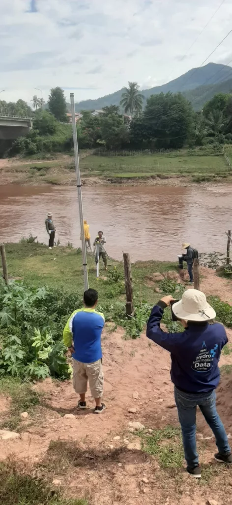
“In order to improve the forecasting chain, key information is time series of river discharges in the basins we want it to work on. In fact, we can calibrate the model using flow rates and this allows to correctly simulate flooding,” the researcher says. “For Cambodia and Laos, however, there is no reliable or recent data available for river flow. Fortunately, we have the ability to estimate it. In fact, WMO has made stations available to measure river levels, and from these it is possible to calculate the corresponding flow rate.”
Therefore, a field measurement campaign began in the summer and will continue until September, that is, throughout the rainy season. During this period, local technicians will visit the gauging stations again and again to relate the measured level to the corresponding flow rate, repeating the operation in different sections of the river.
“One of the most important aspects to consider is that the three pilot basins selected for Laos, as well as the three Cambodian ones, are small basins, between 5,000 and 30,000 km2.To give an idea of the proportions, the Italian main basin, the Po River basin, is around 70,000 km2,” says Dr Alfieri. “One of the most important aspects to consider is that the three pilot basins selected for Laos, as well as the three Cambodian ones, are small basins, between 5,000 and 30,000 km2.To give an idea of the proportions, the Italian main basin, the Po River basin, is around 70,000 km2,” says Dr Alfieri. “But while there is a wealth of hydro-meteorological monitoring data available in Italy, they are scarce for these two countries. Specifically, detailed data is lacking. To accurately model precipitation extremes and, consequently, streamflow extremes, precise data is needed. We have access to some global forecasting models, such as the American GFS model or the German ICON model, but their resolution is too coarse for our purposes, which is to provide accurate flood forecasts and inundation scenarios. Moreover, the basins we are working on have several hydraulic structures that must be considered to avoid modeling errors. For example, the Prek Thnot River basin has various hydraulic works such as dams, detention basins, and diversion channels that redirect part of the water flows to protect the Cambodian capital, Phnom Penh, located at the river’s mouth. These infrastructures need to be included in the modeling to ensure correct hydrological responses.”
For this reason, the project partners are working closely with local stakeholders, and in particular experts from hydrometeorological agencies, to be able to collect information from local datasets and thus ensure the availability of accurate information and high-resolution data. “We are in contact with the Viet Nam Meteorological and Hydrological Administration, which is a neighboring country but whose high-resolution weather forecasting model covers the whole of Southeast Asia, so their forecasts can be used in the operational chain. In general, the goal is to integrate global data, which have lower resolution but can offer the advantage of longer-term forecasts, with local high-resolution data, which provide information on the short term but with greater precision and accuracy,” Dr Alfieri concludes.