The storm Daniel that is pounding Greece has dropped amounts of precipitation equal or even higher than the total annual yield, triggering impactful flash floods. CIMA Research Foundation is monitoring the event
Since last Monday, parts of central Greece has been hit by the storm Daniel, a widespread depression that formed over Southern Balkans on Sunday afternoon. The slow-moving system has brought persistent and intense thunderstorms pouring unprecedented rainfall amounts ranging between 700 and 800mm in 24 hours. It is worth noting that these record-breaking rainfall accumulations are close to or even higher than the annual yield and 10-to-15 times larger than the whole September average.
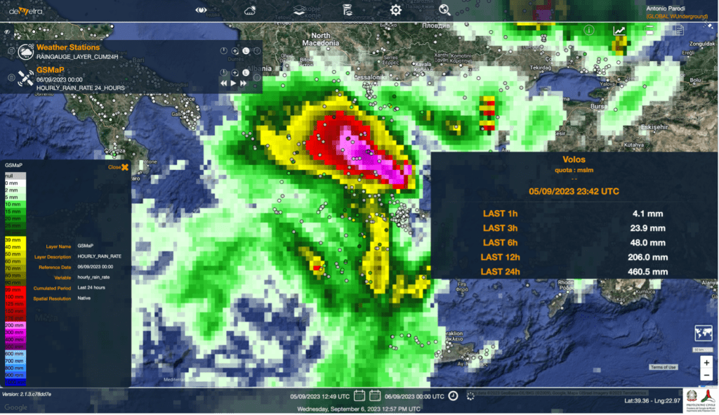
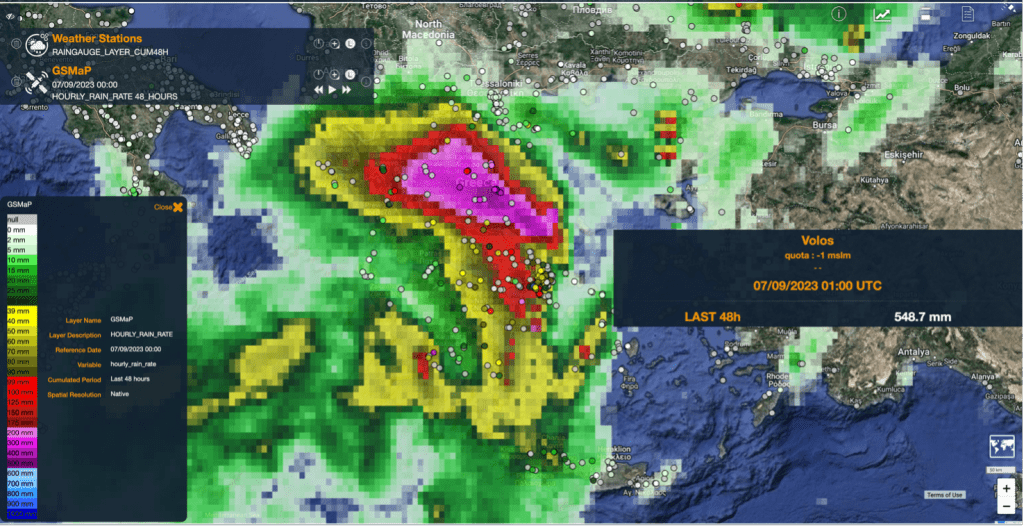
Such intense precipitation has triggered severe flash floods in E Thessaly and specifically on the coastal town of Volos where casualties have been reported on Tuesday.
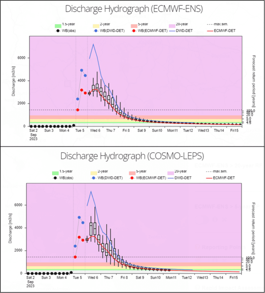
It is still ongoing the hydrologic response of the major local watercourses, namely the Acheloos, Pineios, Spercheios, and Kifissos rivers. The forecasts provided by the EFAS system is anticipating extreme flood peaks, possibly well above the 100-year return period, potentially affecting the main urban areas in the region. In particular, the flooding of the Pineios river has been going on in Larissa, a city-capital of Thessaly inhabited by 150,000 people, since the evening of 6 September, while the flooding of the Spercheios river has been going on since the early hours of today in the surroundings of Lamia (75,000 inhabitants, in the district of Central Greece).
Though the hydrological predictions are fairly consistent, the estimated of the potentially-affected population still has a significant spread, ranging between 5,000 and 25,000 in E Thessaly and Central Greece combined, mostly depending on the effectiveness of the flood protections in place.

The persistence of the severe weather that is hitting Greece is due to the steady high-pressure system on Central Europe. This configuration, called “omega” because of its shape resembling the Greek letter, is not only responsible for the current situation in Greece but it has also fuelled both the inundations that occurred in central Spain in the past weekend and the ongoing heatwave in N Europe that is knocking down previous temperature records across France, England, and The Netherlands. This is evidence, once again, of the link between extreme flood phenomena and exceptional temperatures.
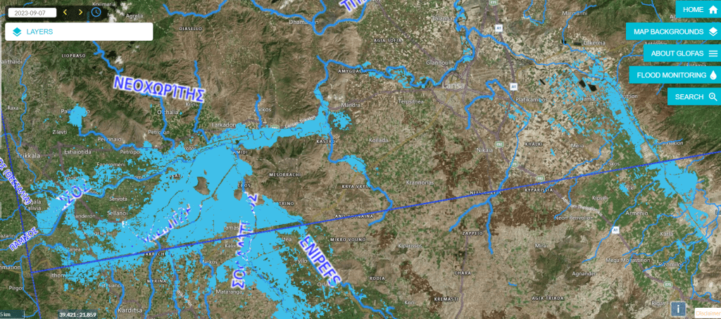
On 9 September, storm Daniel finally left Greece, after leaving devastating floods behind. According to the Sentinel1-based detection provided by both Global Floods Partnership and Copernicus Rapid Mapping, 1,000 km2 of land in E Thessaly were submerged by the floods of the Pineios r. as of September 7. Such an impactful scenario is also supported by the aerial footage of the most affected areas.
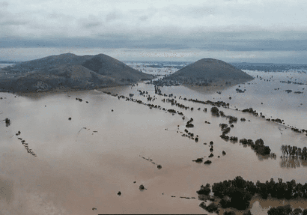
. Ten casualties and 4 missing people are currently by official sources, together with massive disruption to the infrastructures (3,000+ km of the road network are estimated to be currently underwater) and, even more importantly, to the agriculture, as Thessaly accounts for about the 20% of the national total production. Inoltre, i danni agricoli sono ancora più gravi a livello nazionale, perché la Tessaglia conta il 20% della produzione agricola nazionale, con immaginabili conseguenze sulla sicurezza alimentare dell’intero paese.
Update 11 September 2023
After intensifying becoming a tropical-like storm on its southward path, the storm Daniel has made landfall early on Sunday in NE Libya, bringing strong winds and heavy rainfall across the northern coastal stretch of the Cyrenaica region.
Though local raingauges are sparse, satellite estimates confirms that downpours might have reached 150-200mm in 24 hours, unleashing floods of a flashy nature across the region, likely exceeding by far the 1-in-20 years return period threshold. The inundations have hit severely the urban areas of Benghazi and mostly Derna (pop. 45,000) where 150 casualties have been reported by media.

Daniel is now travelling south-east and expected to weaken as it enters Egypt. Though much milder precipitation is anticipated, localised rain-floods in the coming 24 hours are still possible.

For more on these issues: