The twentieth anniversary of the decree that laid the groundwork for the Italian early warning system is approaching. This directive, a body of law issued by the Prime Minister on 27th February 2004, established the organization and functions ensuring the forecasting and monitoring activities of potentially-impactful events such as riverine floods, flash-floods, and landslides, in order to support, also through early warnings, the actors of the civil protection system in deploying risk reduction measures. On the occasion of this anniversary, we review some key elements of the Directive
On February 27, 2004, almost twenty years ago, the “operational guidelines for the organizational and functional management of the distributed, state, and regional national alert system for hydrogeological and hydraulic risk for civil protection purposes” were defined by law for the first time in Italy. In other words, actions, procedures, tools, and the technical-scientific institutional bodies were identified for the first time to address certain risks (specifically hydrogeological and hydraulic ones, such as landslides and floods), distinguishing two phases, a first one dedicated to event prediction and the second concerning the monitoring of the ongoing situation. The whole framework is now known as the Italian Early Warning System Directive, strongly advocated for and carried forward by Professor Bernardo de Bernardinis, at the time director of the Office for Forecasting, Evaluation, Prevention, and Mitigation of Natural Risks of the Italian Department of Civil Protection.
As the anniversary of the Early Warning System Directive approaches, let’s try to summarise its main aspects and key moments of its evolution over the years.
The birth of the Early Warning System Directive and its basic principles
The Directive was born to address the numerous catastrophic events that have affected the national territory, particularly following the disaster that struck the Campanian municipalities of Sarno, Siano, Quindici, and San Felice a Cancello, in May 1998. On that occasion, heavy rainfall triggered many debris flows that caused the death of 161 people. An event of such magnitude made it evident the urgent need of establishing a system specifically tailored to deal with such phenomena, by identifying risk-prone areas, anticipating – within the limits of knowledge and predictability of the phenomena themselves – the possibility of a disaster, monitoring dangerous situations, and implementing all possible mitigation and contrast actions to protect the population.
“The Directive detailed the organization and the tasks of the decentralized functional centers (i.e., the institutional bodies in charge at local scale) of the Civil Protection System by defining the set of warning areas, homogeneous from either a meteo-climatic point of and hydrological response,” says Antonio Gioia, head of the Planning and Procedures Department of CIMA Research Foundation. “But the real innovative element is the organisation of the entire ‘early warning’ process, into a prediction phase, devoted to the anticipation of a possible risk scenario, and monitoring phase, dedicated to the surveillance of the ongoing situation.”
According to this scheme, everything stems from meteorological forecasts, which identify possible precipitation in the warning areas. Based on this prediction, the local services assess the risk level based on their hydrological expertise. Eventually, this may lead to a warning issued by the regional civil protection. “It is the warning that triggers the monitoring and surveillance actions, this is cornerstone of the system the Directive set up. From this moment onwards, in fact, the competent authorities are called upon to monitor the situation and, if the case, to update the predicted scenario with the latest available observations. Besides, the warning issued by the regional system must timely activate the appropriate contrast actions envisaged by the civil protection plans to reduce its impacts of an event,” Dr Gioia continues.
Towards regional autonomy and standardization
The construction process of the decentralized Functional Center system was not short and, pending the activation of regional structures, the activities outlined by the Directive were mostly carried out by the Central Functional Center of the National Civil Protection Department. In fact, the establishment of suitable, effective, and efficient structures, able to operate in conjunction with the central structures, took about ten years, and only at the end of 2014 all Regions and Autonomous Provinces finally managed to put into operations their own services, provided with all the necessary manpower and technical resources.
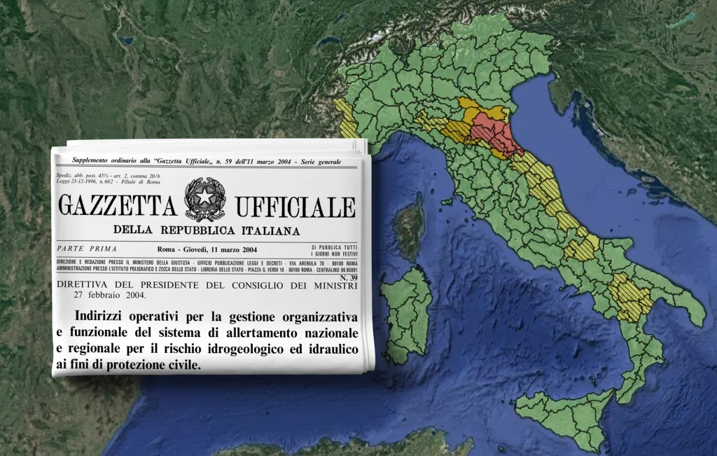
But until a few years ago, there was an even more significant hurdle to overcome, namely the lack of a common glossary and shared lexicon among the different regional bodies. Each functional center, in fact, used different terminologies, codes, and warning levels. Each functional center, in fact, used different terminologies, codes, and warning levels. In particular, some of them issued warnings through a specific colour coding (often with different colors and meanings), others used a numerical one (level 1, level 2, sometimes with totally opposite meaning), others again enforced a qualitative definition (e.g., “severe warning”). This was a significant issue when communication has to be provided to the population residing in border areas, to tourists, or even hampering the exchange of information between civil protection officers of different Regions.
“This problem was addressed with the important integration to the Early Warning System Directive, the operational guidelines issued in 2016. This further complement, compliant to international standards, defined in a univocal way the communication of warning in the whole national territory,” says Dr Gioia. Thus, the warnings were finally born as we know them now, featuring the yellow, orange, and red colour codes.
Moreover, the operational guidelines of 2016 addressed a further risk scenario, the hydrogeological risk related to thunderstorms. Such small-scaled, short-lived, and intense precipitation events, it is worth recalling, are labelled through a specific colour coding, yellow and orange whereas the red color is appropriate for widespread and persisting events.
There is still something else, in addition to the “shape and colour” issue. In the operational guidelines of 2016, in fact, the activation phases of the system are also homogenised at national scale. “In essence, those guidelines have been designed to support a common minimum level of activation of civil protection systems, called operational phases. In other words, each local institution (at regional, provincial, and municipal scale) must deploy, since the prediction phase, a minimum set of actions and countermeasures in line with the issued warning level. However, the link between a warning level and the corresponding operational phase is not automatical” says Dr Gioia. It may seem counterintuitive, but in reality, this aims to make the system more flexible because it requires a comprehensive assessment of both the potential severity of the event (i.e., its magnitude) and the exposures (e.g., how many people) that could be at risk, taking also into account their vulnerability (i.e., to what extent the protection in place could help in dampening the impacts). This flexibility of the system is the key factor for tailoring the actions to be put in operations in a specific territory to protect the population.
“All this path, from the birth of the Directive to its full application, up to the latest updates that have allowed its standardization at national level, has a basic objective: to ensure a gradual and coordinated activation of the civil protection system that, starting from the prediction, reaches out to the population, in a clear, understandable, and unambiguous way, raising the public awareness, and enabling everyone to adopt the adequate measures of self-protection,” concludes Dr Gioia. “The ultimate aim is, of course, protecting the population from hydrometeorological risks, based on the all the available knowledge available, though, it is worth remembering, always carry a degree of uncertainty.”