The passage of a wildfire modifies the landscape in both the short and long term. The types of tree species, their three-dimensional structure, the quantity of biomass, and post-fire vegetation regrowth directly influence flammability, fire regime and, consequently, territorial vulnerability.
At the beginning of February, a group of researchers and technical staff from CIMA Research Foundation, experts in wildfires and forest biodiversity conservation and specialists in monitoring systems and drones, in collaboration with Gabriele Arcangelo Macellaro from the Geo-Environmental Data Laboratory of the University of Basilicata, carried out field activities in a hilly inland area near Albenga that has been severely affected by wildfires in recent years.

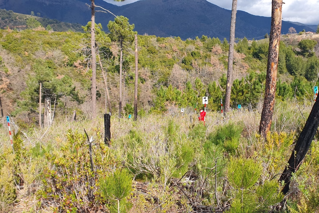
Specifically, the objective of these surveys was to study vegetation structure and condition (biomass, geometric characteristics, and vegetative status) in order to investigate the evolution of the tree and shrub layers following past fires and to highlight their possible future development in relation to potential new fire events. These data are fundamental to improving prevention, risk management and post-fire intervention planning, as well as enabling researchers to define a scalable data acquisition protocol capable of transferring high-definition analyses from local contexts to much larger areas.
Different types of instrumentation were employed: drones equipped with various sensors for aerial data acquisition, ground-based instruments such as TLS (Terrestrial Laser Scanner), in addition to floristic characterization and geolocation of tree species.
Drones and TLS, equipped with LiDAR (Light Detection and Ranging) sensors, are essential for detailed reconstruction of the three-dimensional structure of vegetation. Drone flights also provided spectral reflectance data to analyze the different light bands reflected by vegetation; these data provide information on plant condition and physiological characteristics. Finally, vegetation sampling activities were essential to link sensor-derived data with the actual conditions of the vegetation cover.

The study area was selected not only because it had been affected in the past by fires of varying intensity, but also because of its vegetation composition, ranging from Mediterranean shrubland undergoing regrowth to more closed forested areas such as pine stands or mixed forests. The analysis of these environments helps to understand how the landscape changes after a wildfire and which conditions may render an area more or less vulnerable in the future, enabling the quantification of hazard and predisposition to new events, as well as the identification of medium- to long-term management actions.


