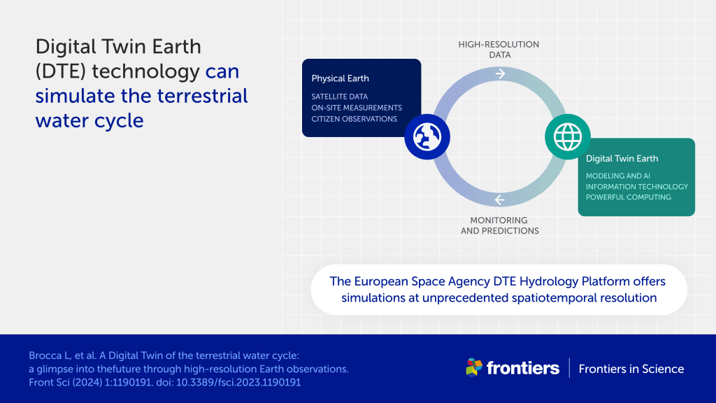
A study co-authored by researchers of CIMA Research Foundation describes one of the most advanced digital twins developed to date. It is a hydrological model that allows for the reconstruction of water cycle dynamics for the entire Mediterranean basin, developed to provide a tool for study and evaluation for water resource management and climate change risk mitigation.
Imagine having a model that allows you to conduct all sorts of simulations. It could be a forest near your home, where you check what happens if the vegetation changes or if a fire breaks out. It could be a city, where you can discover how traffic changes by modifying traffic lights, or the temperature by adding trees. It could be a river where you simulate the movement of boats or floods… Or it could simulate the entire water cycle in the Mediterranean, as the model described in a recent study, published in Frontiers in Science, does. The paper is authored by an international group of authors, including researchers Lorenzo Alfieri, Francesco Avanzi, and Simone Gabellani of the Hydrology and Hydraulics Department of CIMA Research Foundation.
The study presents the results and perspectives opened by the DTE Hydrology project and subsequent related projects, funded by the European Space Agency (ESA) since 2020. The overall objective of these projects is to develop a digital twin that allows for the reconstruction of the hydrological cycle for the entire globe, at high spatial and temporal resolution, leveraging the increasingly rich and refined amount of data from satellites. “Climate change and human activities are profoundly influencing the water cycle: thus, systems for studying and supporting water resource management are becoming increasingly important,” say co-authors Dr Alfieri, Avanzi, and Gabellani.
Virtual (and digital) twins
As we have already reported on our website, the idea of digital twins, namely virtual replicas of certain aspects of reality, is attracting increasing interest in the scientific world. Within the hydrology field, the idea is to enhance knowledge, developments, and modeling of geophysical phenomena using ICT and artificial intelligence technologies to exploit the vast and ever-increasing amount of data we now have available.


This would allow for increasingly realistic representation of different processes and, within a digital twin, create different scenarios and situations that take into account the various elements that interact and influence the water cycle, from snow depth to soil moisture, from precipitation to plant evapotranspiration.
These are evolving technologies, but significant strides have been made.
The DTE Hydrology projects
The one described in the study just published represents one of the most advanced digital twins developed to date. It is the result of a long teamwork, started in 2020 with the DTE Hydrology project, which had led to the development of innovative data for estimating precipitation, soil moisture, and evapotranspiration from satellites. The project served as the basis for its ideal continuations: 4DMED-Hydrology, just concluded, focused on the use of Earth observation data to reproduce the terrestrial water cycle in its various components (e.g., precipitation, soil moisture, surface and deep runoff); and DTE Hydrology Evolution, completed in April 2023, which led to the creation of a validated prototype digital twin for the Po basin and then extended to the entire Mediterranean basin. Both 4DMED-Hydrology and DTE Hydrology Evolution were led by CNR-IRPI.
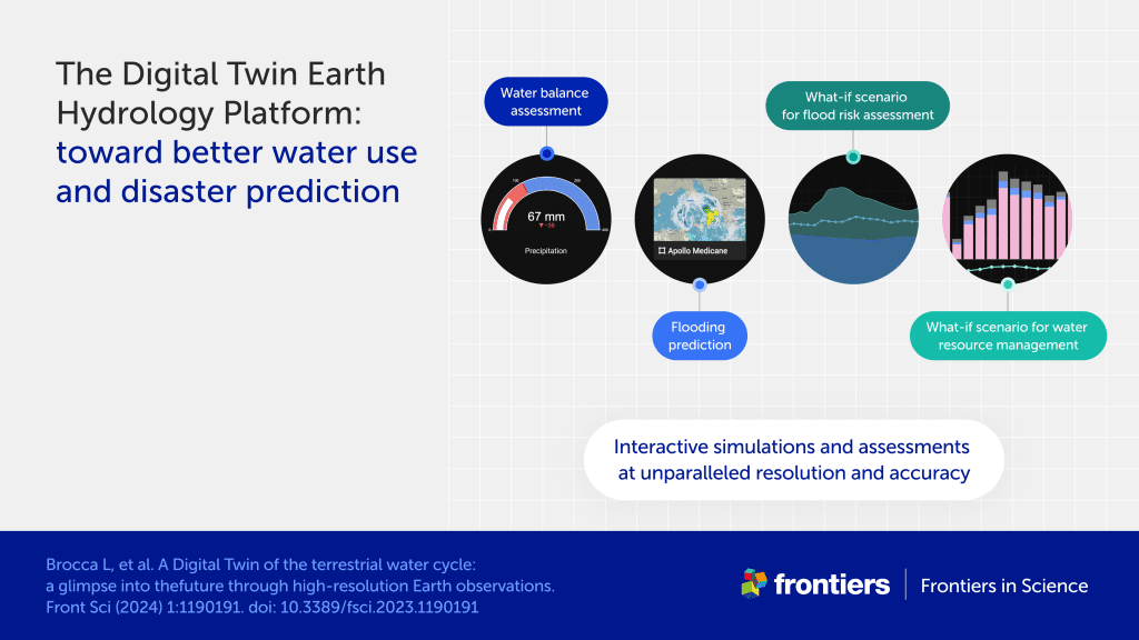
“Although it is still a prototype, the digital twin created as part of DTE Hydrology Evolution allows for various data and results exploration operations. The system combines satellite data with model products, particularly the cryospheric model S3M and the hydrological model Continuum, both developed by the CIMA Research Foundation,” say the three co-authors. “The model was then integrated into a cloud-based platform, ADAMPlatform, which can be used for interactive simulations and visualizations of phenomena such as floods and landslides.”
In short, this is a tool that, continually updated with the latest data, allows for risk assessment, simulation of different situations and outcomes of choices and scenarios. In an era in which many natural phenomena, including those involving water resources, are rapidly changing their frequency and intensity, this kinf of work is crucial. As Luca Brocca, a researcher at CNR-IRPI and lead author of the study, said in a press release, “Collaborations like this, coupled with investments in computational infrastructure, will be crucial for managing the effects of climate change and other human impacts.”
Research for the coming years
Even without being experts in the field, it is easy to imagine how complex it can be to recreate the water cycle on a large scale, with all the different elements at play. Nor, as the authors report in the paper, is it easy to understand how to evaluate the results of such an extensive digital twin. In fact, testing its results requires having observational data available, coming from ground sensors and collected over the years, which confirm its validity. On a scale as large as the Mediterranean basin, collecting ground data, perhaps from regions where the monitoring network is scarce, and doing so for a sufficient time to establish the actual effectiveness of the digital twin represents a challenge that will need to be addressed with further research.
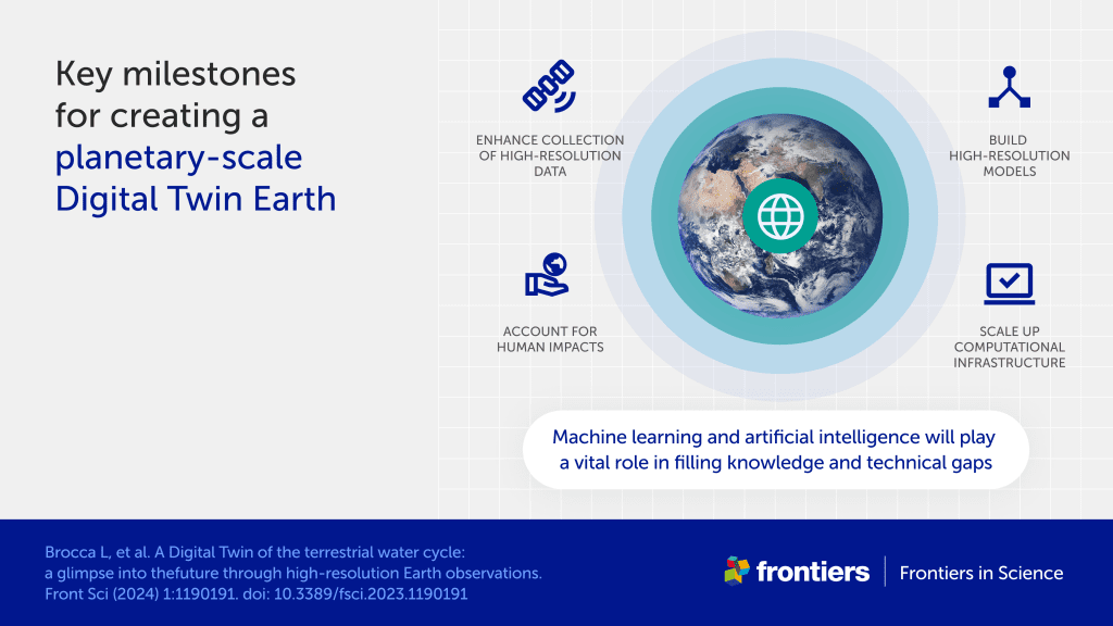
This is not the only challenge: the role of machine learning (and artificial intelligence more generally), the errors and uncertainties inherent in numerical models and satellite products, the need to develop algorithms that allow computers to “keep up” with high-resolution models, are just some of the elements that will need to be worked on as these technologies are refined.
As we have already written, even from the perspective of pure representation of phenomena, there are still limits to overcome. This is the case with the use of water for agricultural and industrial activities, use that profoundly influences the availability of this resource but is anything but easy to simulate. “The human use of water would require data at an even higher resolution than the current one, from about a kilometer to a hundred meters,” say CIMA’s researchers.
“However, the ultimate goal of this type of project is as ambitious as it is crucial. These are activities that contribute to the initiative of the European Commission Destination Earth (DestinE), which aims to develop a Global Digital Twin to replicate not only the water cycle but all major natural phenomena and their interaction with human activities,” conclude Dr Alfieri, Avanzi, and Gabellani. “In essence, an earthly twin that allows for a realistic study of risks to study appropriate mitigation and adaptation strategies.”
