The World Drought Atlas, the most comprehensive global publication on drought risks and impacts, is presented at COP16. This landmark initiative, coordinated by CIMA Research Foundation and developed through collaboration with international experts, integrates data, maps, and case studies to support drought management and resilience strategies.
Drought, a silent but devastating threat, is emerging as one of the most critical climate risks of our time. In response to this global emergency, we present the World Drought Atlas, an unprecedented work that combines scientific data, interdisciplinary analysis, and practical solutions to strengthen global resilience.
Jointly developed by CIMA Research Foundation, the Joint Research Centre (JRC) of the European Commission, the International Drought Resilience Alliance (IDRA), the UN Convention to Combat Desertification (UNCCD), Vrije Universiteit Amsterdam, and the United Nations University Institute for Environment and Human Security, the Atlas aims to raise awareness among policymakers and the public on the urgency of implementing concrete measures to address one of the world’s most costly and deadly natural hazards.
The Atlas is being presented at the 16th Conference of the Parties (COP16) of the UNCCD in Riyadh, where negotiators are discussing a pivotal decision to enhance global resilience in the face of increasingly severe droughts. The official launch takes place on December 2, from 6:00 PM to 7:00 PM (Riyadh time), during the opening ceremony of the Resilience Pavilion. A dedicated side event provides an opportunity to delve deeper into its content and foster international dialogue.

A global challenge, a collective response
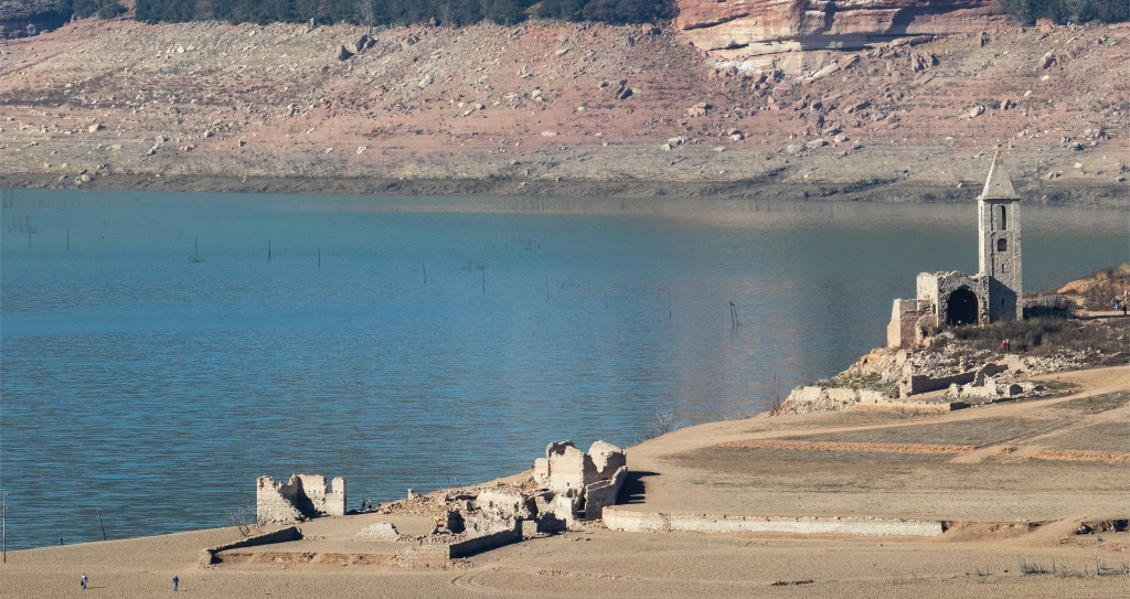
Drought has systemic impacts, affecting agriculture, energy, riverine transportation, international trade, and ecosystems. It exacerbates inequalities, conflicts, and public health threats. To visualize and comprehend these interconnections, the Atlas integrates maps, infographics, and case studies, offering an accessible tool for both specialists and non-experts.
“The challenge of drought cannot be tackled by a single sector or nation. The World Drought Atlas brings together experts from diverse disciplines and countries to create a comprehensive tool for understanding and visualizing drought impacts while proposing sustainable solutions. This collaborative effort serves as a model for political action, emphasizing that collective commitment is essential to building resilient and less vulnerable societies,” said Lauro Rossi, Program Director at CIMA Research Foundation and one of the Atlas coordinators.
A data-driven journey to combat global drought
Recent data suggests that by 2050, three out of four people worldwide will be directly or indirectly affected by drought. Despite this projection, many nations and economic sectors remain ill-prepared for increasingly frequent and intense events.
Through 21 case studies, the World Drought Atlas analyzes drought impacts and responses in diverse contexts, from the river basins of China and the United States to the Central American Dry Corridor. These examples underscore that no country is immune and that adaptation strategies must be tailored to local conditions, including the knowledge of Indigenous communities.

The Atlas also introduces a proactive approach to drought management, offering recommendations across three key areas:
- Governance: Early warning systems, incentives for sustainable water resource management, and micro-insurance for farmers.
- Land Management: Practices such as land restoration and agroforestry.
- Water Management: Wastewater reuse, aquifer recharge, and conservation technologies.
Science for action
The World Drought Atlas is not merely a scientific document but a manifesto for action. As Ibrahim Thiaw, Executive Secretary of UNCCD, stated, the launch of the Atlas provides an unprecedented knowledge base to guide historic decisions at COP16 and beyond.
With contributions from CIMA Research Foundation and other international partners, the Atlas represents a milestone in the fight against drought, offering an integrated vision and actionable tools to build a resilient future. The question it poses is clear: Are we ready to seize this opportunity?