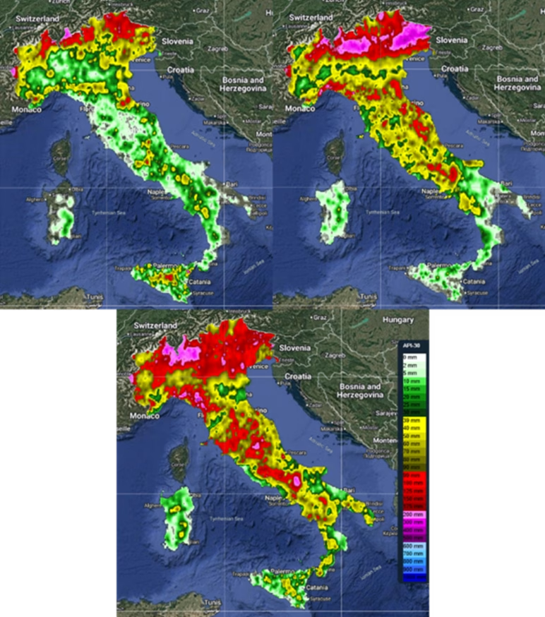
Violent thunderstorms recorded especially in August were the clearest signal of this contradictory summer. Hailstorms and flash floods struck in localized fashion but with intense effects, showing how the alternation between prolonged periods of heat and sudden perturbations leads to an increase in the energy available for extreme phenomena. These events are not exceptions, but the symptom of an unstable atmosphere, made more fragile by global warming. They impacted territories and communities, causing immediate damage and showing how meteorological anomalies do not merely alter seasonal averages, but find their most evident expression in short, destructive phenomena.
Significant hydrological events accompanied the meteorological anomalies, highlighting water and territorial vulnerability. Among the most significant episodes were the flooding of the Rio Frejus in Bardonecchia on 30 June; the severe thunderstorms of 20 August in the province of Grosseto and on Elba Island; the intense precipitation of 1 and 21–22 September in Liguria, which caused flooding of watercourses and widespread inundations; and finally, the flooding of the Seveso in Milan on 22 September.
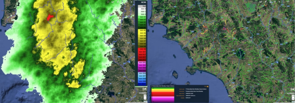
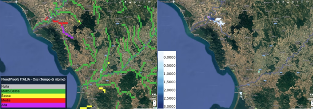
These events were also monitored thanks to the tools and models developed by CIMA Research Foundation for the National Civil Protection Department. Among the most relevant innovations is hydrological nowcasting, i.e. very short-term forecasting (within a few hours) of the hydrological response to intense meteorological events. The August 20 event in the province of Grosseto is an emblematic example: the forecast maps showed, on the one hand, the cumulative precipitation expected in the following hours and, on the other, the river network reaches subject to significant increases in streamflow. Observations later confirmed both the rise and the severity of the discharges, highlighting the areas at risk of flooding, consistent with what had been estimated by hydraulic modelling.
At the national scale, hydrological modelling made it possible to identify the most critical river stretches. Return period analysis showed that Liguria was one of the most affected regions, with widespread criticalities along almost all rivers from west to east. Other criticalities were observed on the Seveso, the Serio and some minor tributaries of the Tiber, while in Southern Italy the events were limited and localized, such as in the province of Enna.
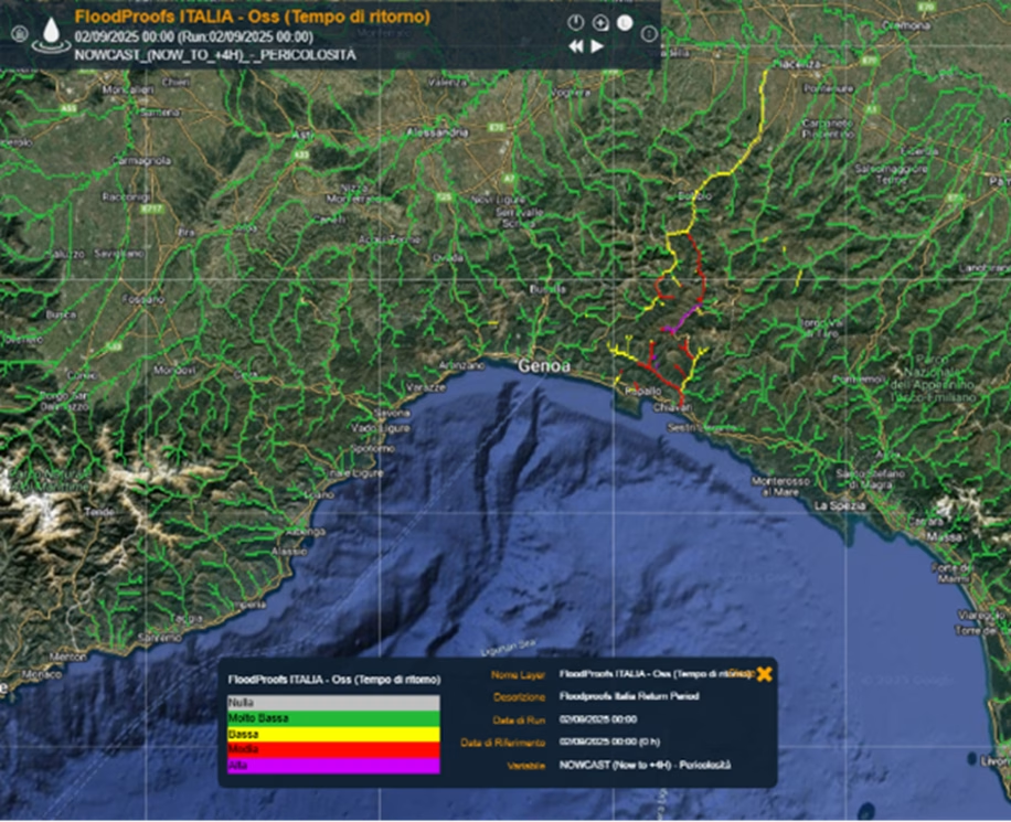
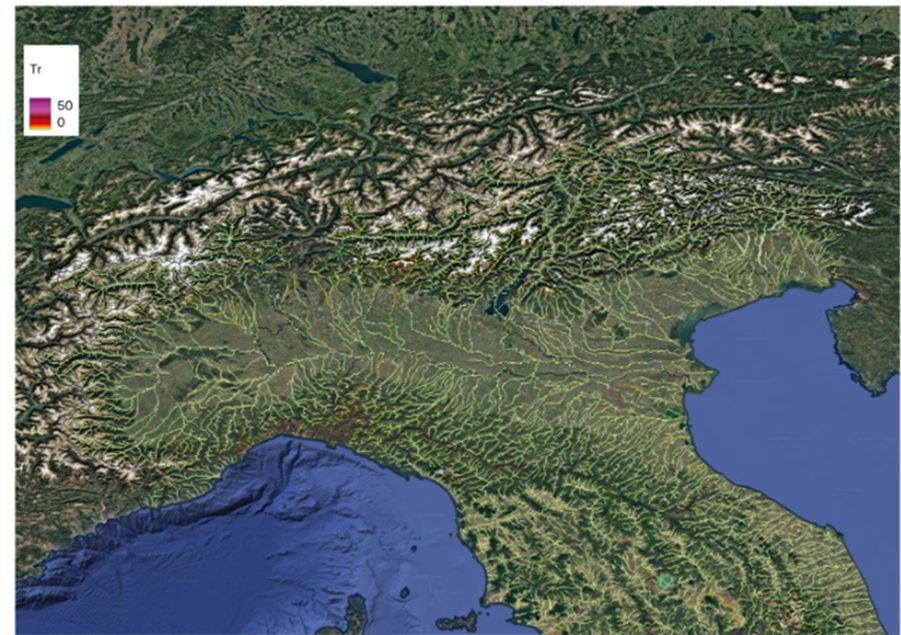
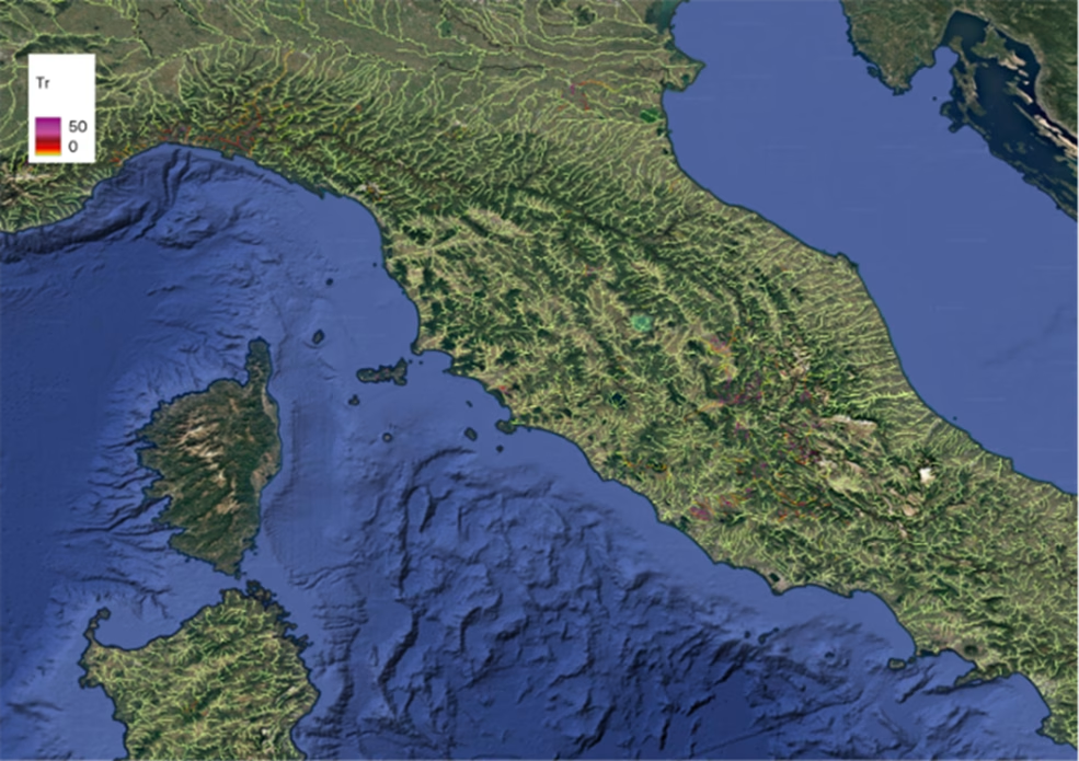
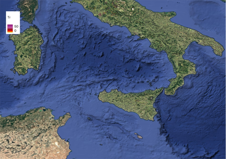
Maps of the maximum severity reached during summer 2025 for Northern, Central and Southern Italy. Areas without significant criticalities appear in green; in Liguria most rivers from west to east show intense events. Other evident criticalities on the Seveso, the Serio and some minor tributaries of the Tiber. In Southern Italy, only a few localized areas (e.g. province of Enna).
Rain-gauge threshold analysis also confirmed the intensity of summer 2025: there were 11 exceedances of thunderstorm thresholds over 1- and 3-hour durations, compared to 3 in previous years, and 2 exceedances of stratiform thresholds over 6–24 hours, when none had been recorded in summers 2023 and 2024.
