In the early hours of July 4, 2025, the Texas Hill Country region was struck by an extreme meteorological event. Within a few hours, between 130 and 280 mm of rainfall fell on soils made poorly permeable by a recent dry spell, triggering a sudden rise in the Guadalupe River of over 8 meters in just 45 minutes.
The event resulted in numerous fatalities and extensive damage, as seen in satellite imagery, highlighting the speed and intensity typical of such phenomena. While past events of similar magnitude have occurred in this area, the exceptional rapidity of this one played a critical role in the catastrophic outcome, particularly regarding the loss of human life.
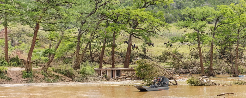
Flash Flood Dynamics and the Guadalupe River
The hydrometric chart for the Guadalupe River at Comfort clearly illustrates the event’s rapid onset: water levels rose from low-flow conditions to over 34 feet (~10.3 meters), well above the major flooding threshold of 28 feet (~8.5 meters), in less than two hours.

According to NOAA, water levels exceeding 21 feet (~6.4 meters) are considered flood stage, while 10 feet (~3 meters) marks the action stage. Further upstream, the hydrometeorological event took on even more extreme characteristics locally. At the Hunt station on the Guadalupe River, 170 mm of rainfall accumulated in just three hours—a value with an estimated return period of 100 to 200 years. In the same location, the river surpassed its historical maximum level since measurements began, exceeding the maximum alert threshold by over 3 meters.
The Camp Mystic girls’ summer camp, located in Kerrville, experienced a particularly tragic toll due to a fatal combination of factors. Its location near the river and at the confluence with a secondary tributary made the site especially vulnerable. The sudden flood wave occurred at dawn while most campers were still asleep, catching everyone off guard. Additionally, the camp’s position in the upper basin (drainage area of about 300 km²), characterized by relatively steep slopes, led to an extremely rapid hydrological response, with only about one hour between the intense rainfall and the peak of the flood wave.
This type of dynamic is typical of flash floods, where basin response is extremely fast and risk mitigation response times are minimal. Exacerbating this behavior, the area was experiencing exceptional drought conditions—among the most severe classified by the U.S. Drought Monitor—prior to the flood. Severe drought can render soil more impermeable, thus accelerating runoff and increasing peak flow.
The alternation of extreme hydrological events, from drought to sudden flooding, is a hallmark of climate change. Similar events have occurred in Italy in recent years, such as the devastating flood in the Misa River basin in the Marche region in September 2022.
Such phenomena present significant challenges to hydrological forecasting, especially in small watershed contexts.
Meteorological Dynamics and Climate Change
The event was triggered by the trailing edge of Tropical Storm Barry, which favored the development of a mesoscale convective system (MCS) capable of producing extremely intense rainfall, with accumulations between 200 and 250 mm in a few hours—equivalent to about four months of average precipitation. As early as the morning of July 4, synoptic analyses indicated active cyclonic vorticity over Texas and strong atmospheric instability.

NASA satellite imagery clearly revealed the compact structure of the convective system, and IMERG data showed very high precipitation rates (mm/h) over the affected area.


Another key factor was the positive sea surface temperature anomaly in the Gulf of Mexico (approximately +2-3°C above average), which provided energy and moisture to the atmospheric system, fueling both the tropical storm and the intense rainfall.
This residual moisture acted as a trigger for MCS development. Additionally, the geomorphological vulnerability of Central Texas played a role: thin, rocky soils and steep hilly terrain funnel rainwater quickly into rivers, earning the region the nickname “Flash Flood Alley.”

Preliminary estimates suggest that the event was intensified by climate change, with rainfall levels up to 10% higher than those recorded in similar past episodes. Available analyses indicate that such events are becoming more frequent and severe—not only due to natural climate variability but also because of anthropogenic global warming.
Impact-Based Forecasting: A Scientific Perspective
The Texas flood serves as a significant case study for understanding the interactions between meteorological dynamics, hydrological response, and territorial impacts, and particularly for analyzing why the event intensified so rapidly. This highlights the challenges associated with forecasting and communicating flash floods, and the need for integrated approaches combining advanced forecasting models with knowledge of local vulnerabilities.
Nocturnal events with rapid hydrological responses, such as that of the Guadalupe, underscore the complexity of alert communication in highly exposed contexts—such as recreational or educational facilities—and the importance of organizational and technological solutions that reinforce and accelerate the transition from early warning to early action.
Traditional forecasting models, based primarily on meteorological and hydrological variables, may be insufficient to anticipate real impacts on the ground, especially in small basins. The scientific approach we are implementing in several parts of the world is that of impact-based forecasting and early warning (IBF-EW), which integrates information on vulnerabilities, exposure, and response capacity to improve risk understanding and scenario communication.
In parallel, there is a growing need to update hydraulic infrastructure and management plans to account for more intense and frequent extreme events, which exceed the historical parameters used in past design practices.
Investing in scientific research on early warning systems for these rapidly developing events—which, due to climate change, are expected to become increasingly frequent—as well as in high-resolution modeling and risk analysis, with particular attention to vulnerable groups (children, the elderly, people with disabilities) and fragile communities, is essential to strengthen resilience.