The snow season has entered its central phase and, as often happens, snow accumulation does not evolve along a linear path. After an early season marked by widespread delays, January brought a significant acceleration, with widespread snowfall across large portions of Italy’s mountain regions.
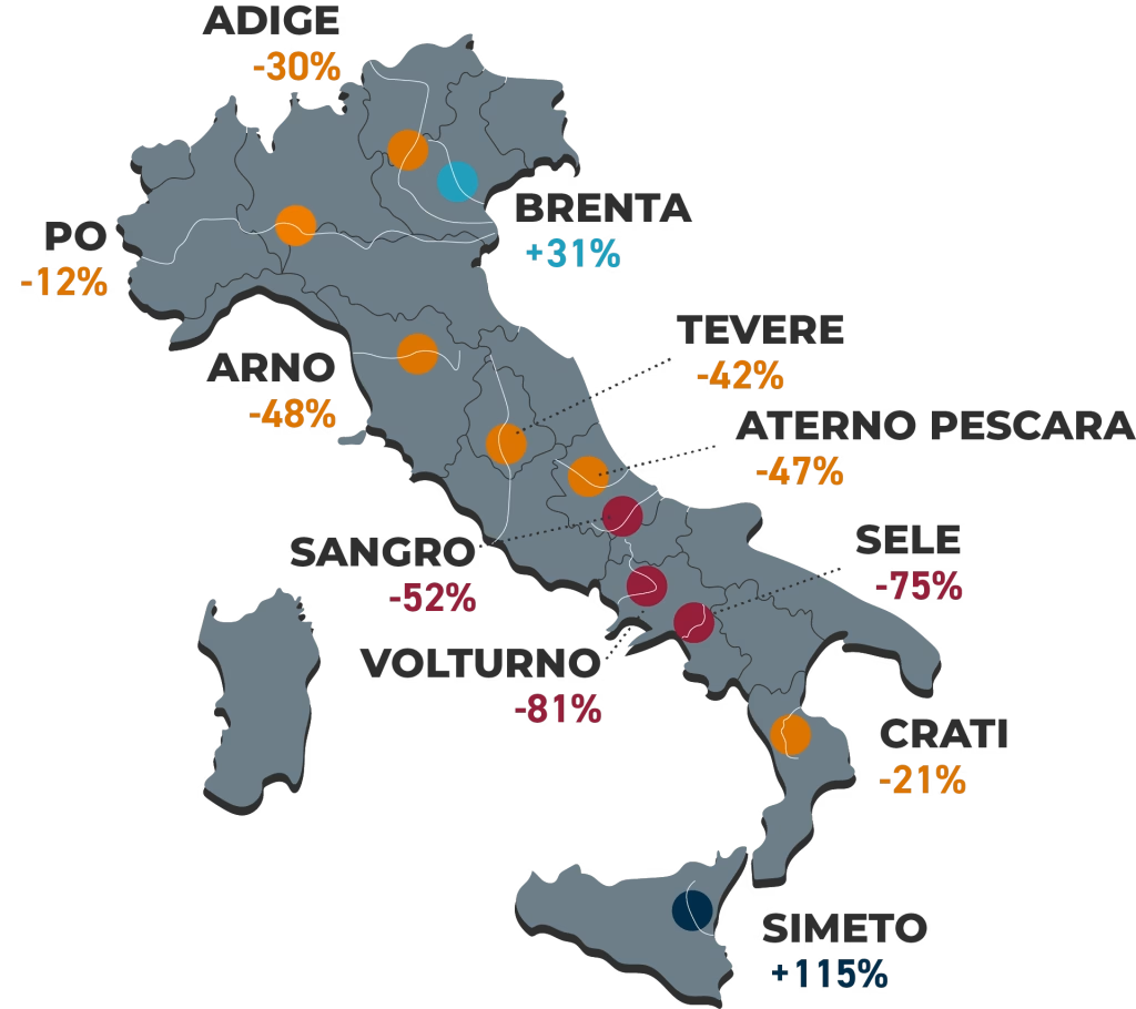
The third update from CIMA Research Foundation shows a national picture that is still slightly below average (–22%), but with a clear improvement compared to previous weeks.
The marathon has changed pace, but the race is not evenly balanced.
The Italian Alps as a whole: a new dataset, finally back to average
For the first time, CIMA Research Foundation presents an aggregated analysis of Snow Water Equivalent across the entire Italian Alpine arc. The impact of January’s conditions is evident: accumulation has returned in line with the seasonal average, thanks to a steady and continuous increase throughout the month.
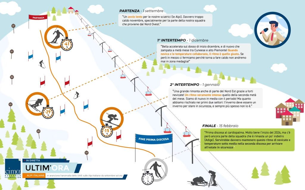
When observing Alpine SWE throughout the winter, its trajectory almost resembles an Olympic downhill race: a slow start in September, a technically challenging section in November, a difficult intermediate split in December, and then acceleration in January. A truly winter-like phase, with below-average temperatures across the Alpine arc and above-average precipitation over much of Northern Italy, brought the curve back on track.
At a time when attention has been focused on ski slopes and the Milano-Cortina 2026 Winter Olympics, with athletes such as Federica Brignone competing on Alpine snow, Italy’s snow season also appears to have found a change of pace. Yet, as in competition, performance in a single sector is not enough, continuity along the entire course is what ultimately matters.
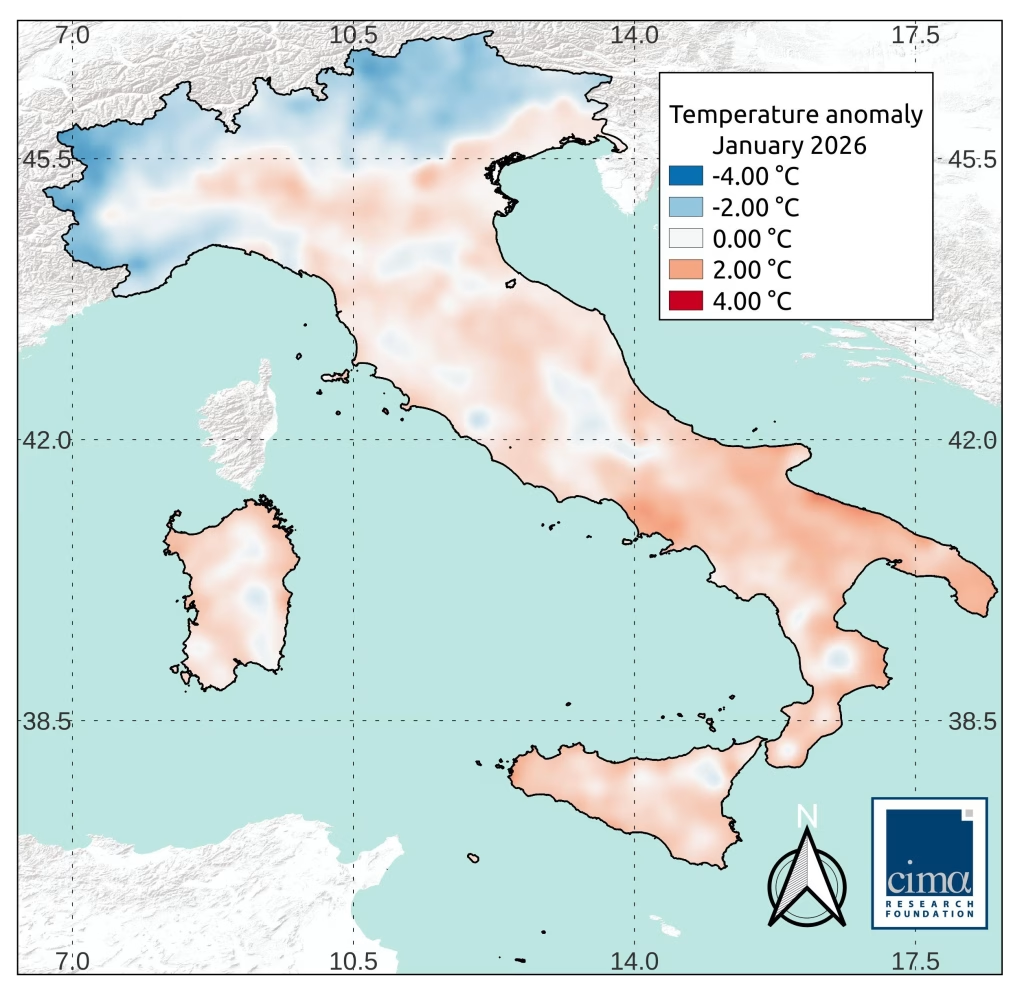
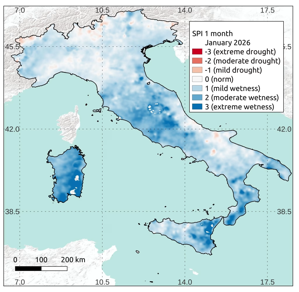
The meteorological context clearly explains this dynamic. During January, temperatures were below average across the Alpine arc, while precipitation was above normal over much of Northern Italy, with some exceptions along border mountain ranges. This combination of cold temperatures and fresh snowfall is the most favorable condition for snowpack growth.
Apennines: slower recovery, shorter season
The situation differs in Central and Southern Italy. January also brought precipitation here, but within a context of above-average temperatures. In the Apennines, the deficit stands at approximately –39%, and accumulation has recovered more slowly than in the Alps, precisely because higher temperatures counteract new snowfall.
The difference is not only quantitative but also seasonal: at these latitudes, the system is gradually approaching the period when snow accumulation reaches its peak and begins transitioning steadily into runoff. The time available to close the gap is diminishing.
The contrast between the Po and Adige basins
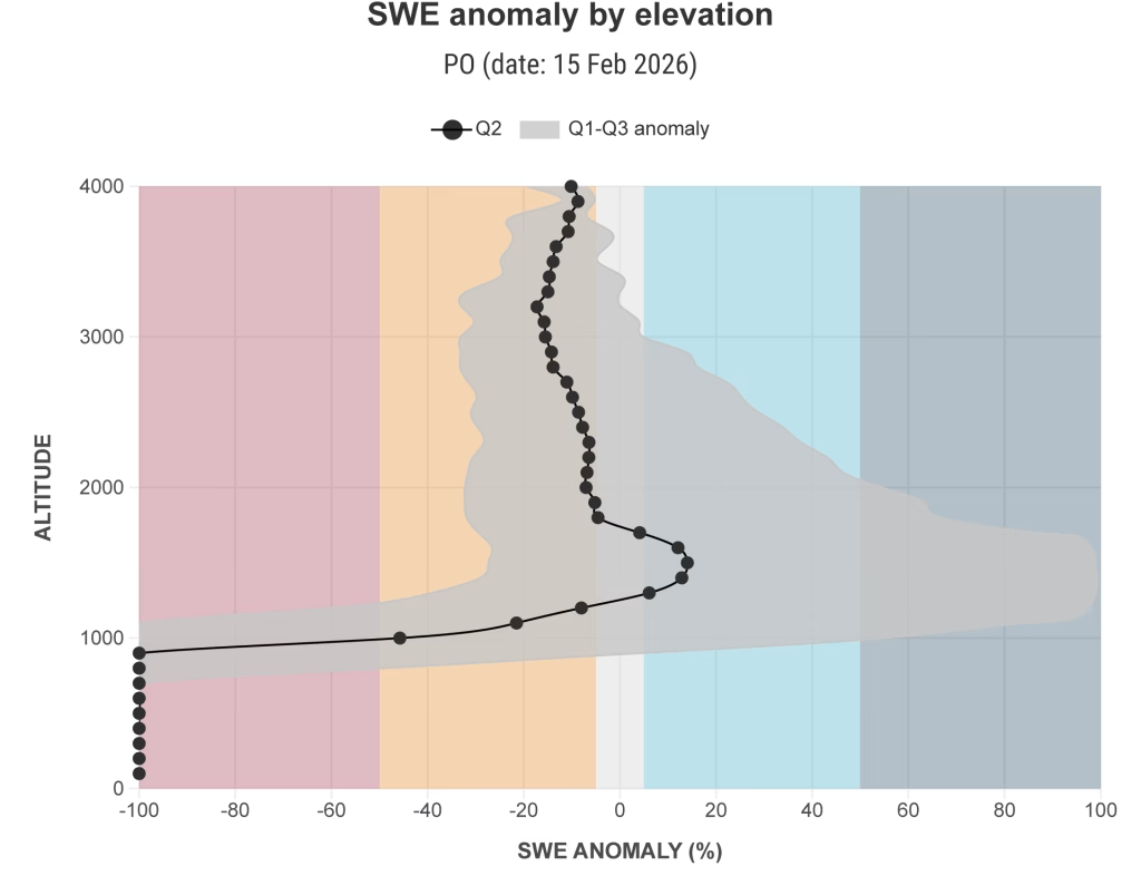
January’s effect is particularly evident in the Po River basin, where accumulation has fully benefited from snowfall, especially in Piedmont. In some areas of the provinces of Turin and Cuneo, surpluses reach +150%, while the basin-wide value stands at –12%, well within normal seasonal variability.
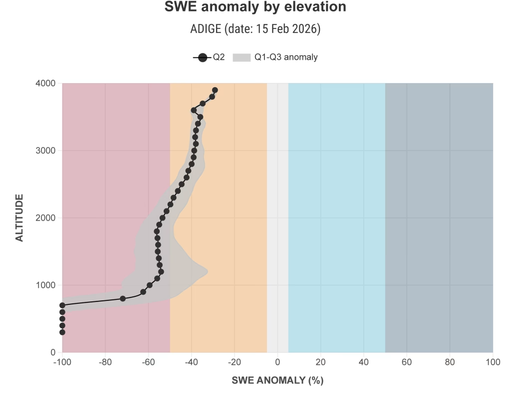
In the Adige River basin, however, conditions remain more critical. The deficit stands at –30%, and the seasonal trajectory closely mirrors last year’s pattern at this point in time. The basin remains below its “normal” variability range, indicating a continuing snow drought condition.
Altitudinal distribution further highlights marked differences. In the Po basin, from 800 meters upward, conditions are close to average, with even a surplus between 800 and 1500 meters, precisely in the foothill areas that had shown greater vulnerability in recent years.
In contrast, along the Adige basin, deficits persist throughout the entire elevation profile, particularly at mid to low elevations, while only the highest elevations show relatively better resilience.
Tiber basin and Apennine variability
The Tiber River basin reflects the Apennine dynamics, with a deficit of –42%. In this case, however, the value still falls within normal seasonal variability.
Why is –42% in the Tiber considered normal variability, while –30% in the Adige is not? As Francesco Avanzi, snow hydrology researcher at CIMA Research Foundation, explains: “In the Apennines, snow accumulation varies much more from year to year than in the Alps. It accumulates at generally lower elevations and is strongly influenced by moist air masses from both the Tyrrhenian and Adriatic Seas, what we call a ‘maritime snow’ regime. This high interannual variability means that even marked deficits can still fall within the natural range of variability. In the Alps, by contrast, accumulation is more stable from year to year; therefore, even a smaller deviation (such as –30%) may signal a structural snow drought.”
Contrasts and seasonal outlook
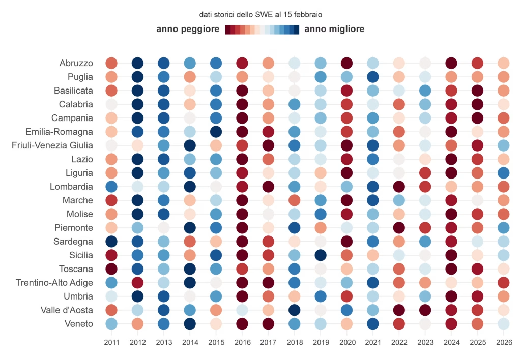
Overall, the current snow season is characterized by marked contrasts. For some regions, such as Piedmont, this is among the best snow seasons since 2010–2011; for many others, values remain below the average of the past fifteen years.
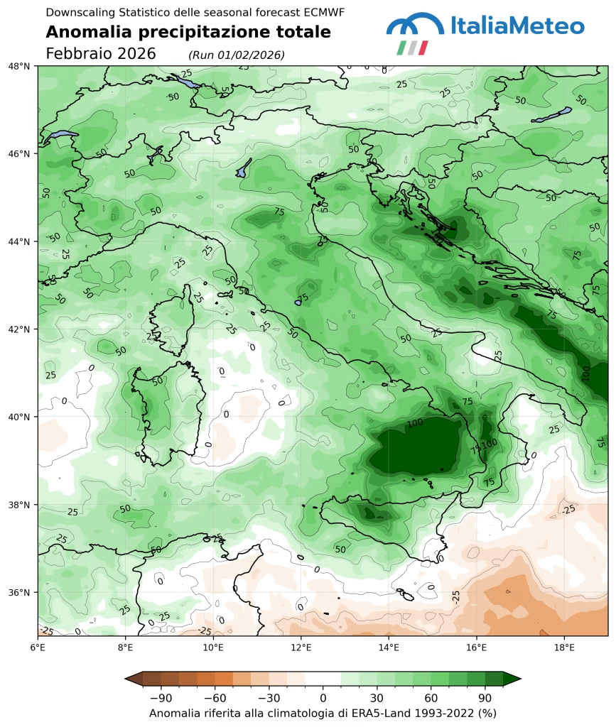
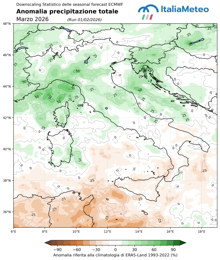
Seasonal forecasts from ItaliaMeteo indicate a very wet February across Italy, with potentially continued wet conditions in the North-West in March, while Southern Italy may experience slightly drier conditions in March.
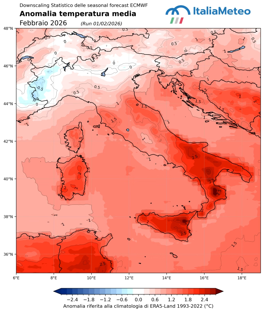
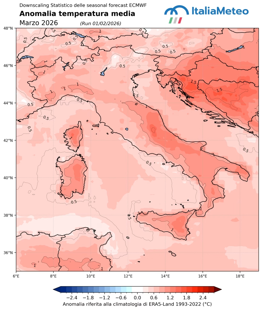
On the temperature side, February and March are expected to see a progressive return of positive temperature anomalies across much of the country. This could accelerate snowmelt and significantly influence the final seasonal balance between accumulation and runoff.
Toward the decisive phase of the season
January marked a turning point, bringing many Alpine areas back close to average conditions. Nevertheless, the season remains heterogeneous and still open.
The coming phase will be decisive: between abundant precipitation and rising temperatures, the balance between accumulation and melt will determine spring and summer water availability. The next update, scheduled for mid-March, will allow a more comprehensive assessment of these evolving dynamics.
