A Multi-Sensor Precipitation Grid was presented last Wednesday 6 July to potential Caribbean data users, including forecasters, water resource managers and disaster managers.
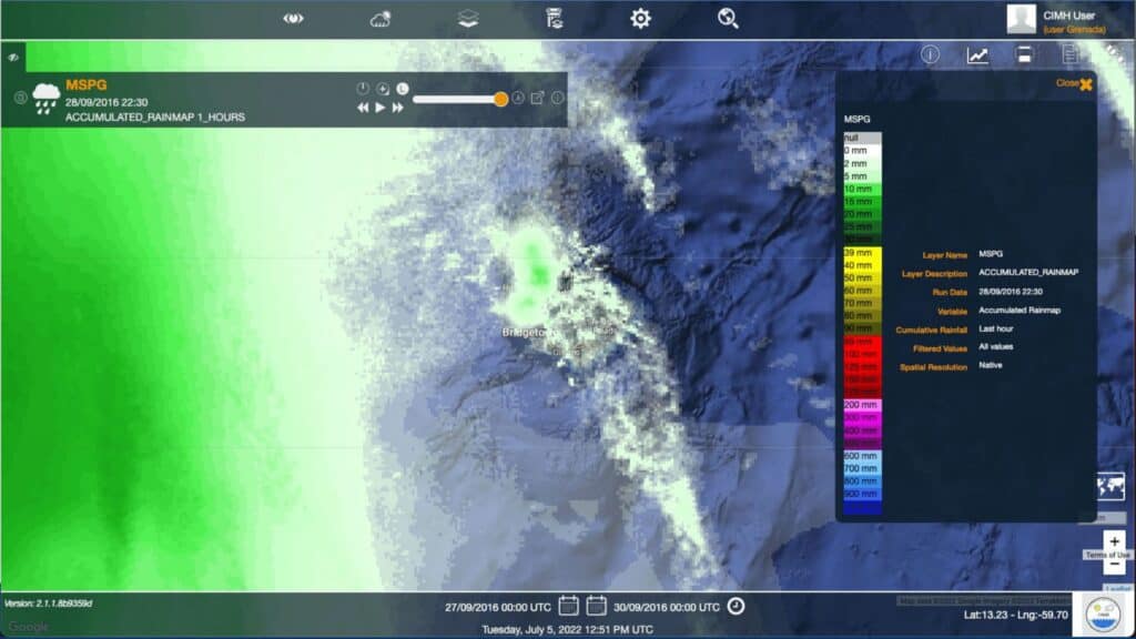
The prototype system, developed by CIMA Research Foundation in close cooperation with the Caribbean Meteorological Organisation Headquarters Unit (CMO HQ), the Caribbean Institute for Meteorology and Hydrology (CIMH) and the Barbados Meteorological Service (BMS), combines existing sources of rainfall information to produce a rainfall grid. This is achieved by merging data from the existing regional rainfall observing network, available radar derived rainfall estimates and satellite-derived products. The prototype system produces both spatial and temporal estimated rainfall at a fine resolution (30 min, 500-meter resolution) for a sub-region of the Eastern Caribbean that currently includes Barbados, Saint Lucia, St. Vincent and the Grenadines, and Martinique.

During the workshop, the potential users had the occasion to query, visualize, explore, analyze and download the sub-regional multi-sensor grid data in additional to forecasted rainfall beyond the latest observations. The feedback collected from the potential users will be used to further enhance the system, which is due to be finally released in September this year. This represents a crucial step towards the near real-time assessment of adverse rainfall events, enhancing hydro-meteorological forecasts and impact-based forecasting workflows.
he project is part of the Climate Risk and Early Warning Systems (CREWS) Initiative, a partnership for enhancing climate resilience and strengthening early warning services in least developed and small island states. CREWS is implemented by the World Meteorological Organization (WMO), the World Bank together with the Global Facility for Disaster Reduction and Recovery (WB/GFDRR) and the United Nations Office for Disaster Risk Reduction (UNDRR).