EARLY WARNING SYSTEMS IN AFRICA
As is well known, the risk of disasters is extremely high in Africa, and the climate crisis has made certain phenomena, such as floods and droughts, more frequent and intense. In recent years, in fact, intense rains and floods have affected many African countries, as evidenced by the data on the most significant extreme events of recent years, forcing hundreds of thousands of people to leave their homes, jobs, and schools. Water-related risks exist even when water is scarce: droughts also affect an increasingly large part of the African population. In 2018, only about 40% of the African population had access to alert systems or Early Warning Systems (EWS): which translated into much higher losses. This leads to an even higher risk scenario, in which the lives and well-being of people are severely threatened.

In 2018, under the commission of UN Office for Disaster Risk Reduction (UNDRR), CIMA Research Foundation created risk profiles to estimate the impacts of floods and droughts on current and future climates, as well as on the socio-economic projection of 16 countries in sub-Saharan Africa.
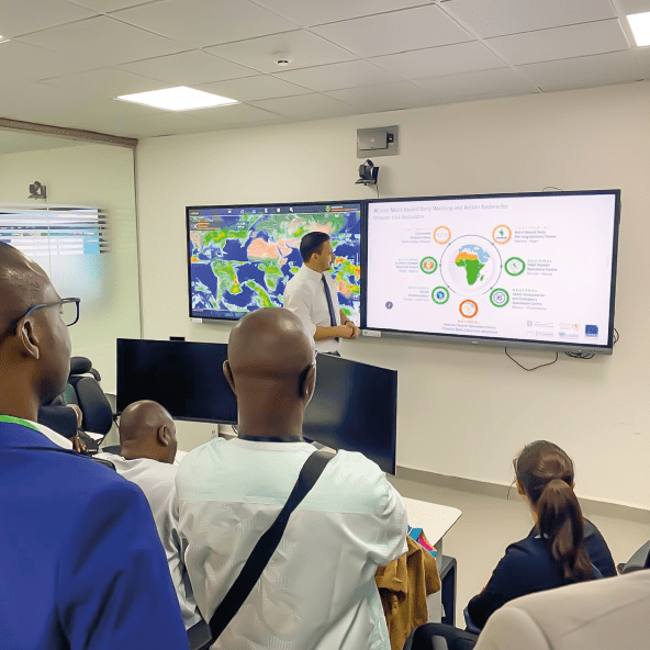
Given the scientifically predicted high vulnerability of the continent and thus the need for an adequate early warning system, a ten-year Road Map for the implementation of the Africa Multi Hazard Early Warning and Early Action System – AMHEWAS was approved in 2020, under the initiative of the President of the African Union Commission (AUC). The primary objective is to increase the availability of and access to multi-hazard early warning systems, focused on different types of risks, taking into account their possible compound effects.

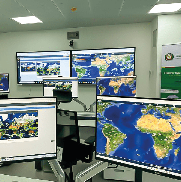
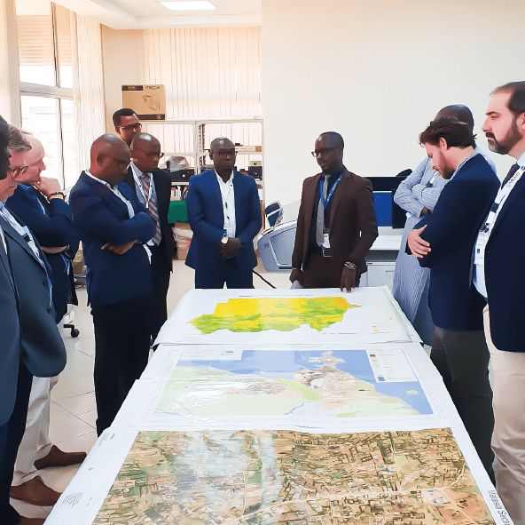
Starting from the review of the legal and institutional framework, the mechanisms for coordination and information and data exchange have been established between different administrative and operational levels (continental, national, regional). With the contribution of CIMA Research Foundation, which has closely followed its implementation, there is now a network of centers for forecasting, data analysis, monitoring, and response to hydrometeorological risks. These centers operate 24/7 and represent the operational core of the system.
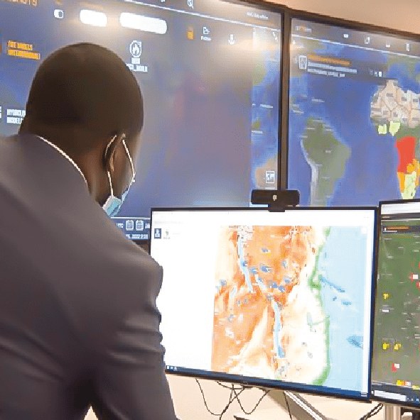
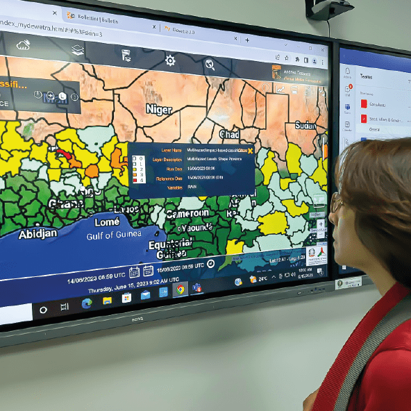
The network of existing centers uses the myDEWETRA platform, developed by CIMA Research Foundation for the Italian Civil Protection Department, which today integrates and collates an enormous amount of real-time data for monitoring and forecasting severe events worldwide. The results are then communicated to the various system actors through standardized warning bulletins, based on which early response actions (Early Action) are deployed to mitigate the impacts.
CONTINENTAL WATCH
FORECASTS (UP TO FIVE DAYS) ON WINDS, INTENSE PRECIPITATION, AND FLOODS
AFRICA DROUGHT WATCH
IMPACT-BASED
INFORMATION FOR DROUGHT RISK
EMERGENCY SITUATION REPORT
IN CASE OF AN ONGOING OR IMPEDING SIGNIFICANT EVENTS
DETAILED OVERVIEW OF THE CURRENT SITUATION AND ITS IMPACTS
Each of these tools is the result of a collaboration involving experts from both the Continental Situation Room, located at the African Union Commission headquarters in Addis Ababa (Ethiopia), and the regional Situation Rooms, who provide local hydrometeorological information. The bulletins are then distributed to the various national authorities that are mandated to issue alerts to the population.
The entire process receives unwavering technical and scientific support from UNDRR experts and CIMA Research Foundation, which is also committed to train the local personnel operating to ensure their full autonomy.
Among the impacts we analyze for floods and droughts, we carry out research studies on the risk stemming from displacement, i.e., the forced migration of people, which can occur in the wake of a disaster. On this topic, we work together with the Internal Displacement Monitoring Centre (IDMC) in many regions around the world, including the Greater Horn of Africa.
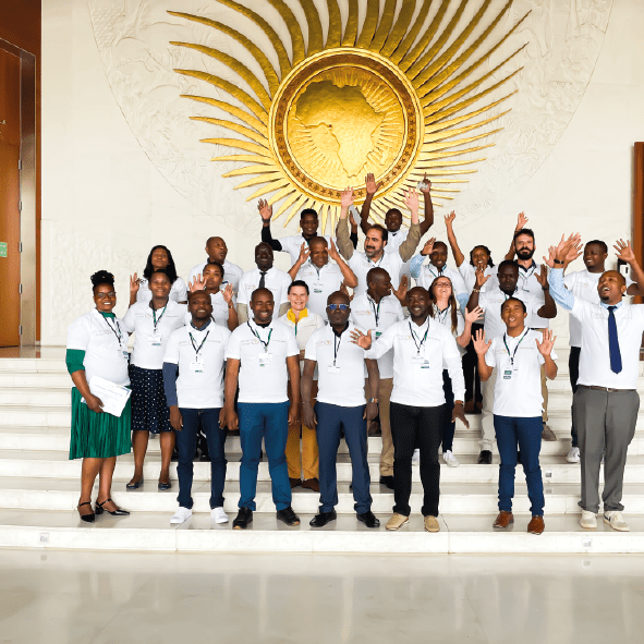
Furthermore, since 2023, the Italian government, as part of the EW4All Initiative, has financed, through UNDRR and with the scientific support of CIMA Research Foundation, the creation of a Network of Excellence (NOE) for risk reduction in Africa. The initiative aims to create a network of excellence—similar to the Italian network of competence centers—to bring together centers of African and international experts, becoming a platform for exchange among research centers, specialized agencies, universities, and risk management authorities.
In addition to these continent-wide initiatives, CIMA Research Foundation is active in Africa with many other projects. Always closely collaborating with local entities, some of these projects have had to deal with complex geopolitical situations, such as the conflict in Sudan, where we were (and still are) engaged in strengthening the country’s technical and operational capacities for disaster prevention and management. Many projects share the general goal of enhancing disaster risk prevention, management, and resilience (such as the WHCA – Water at the Heart of Climate Action Project and Ready2Act), through strategies that include training, technology transfer, and the fostering of cooperation and collaboration.

Flood, drought and fire projects to date have involved 36 African countries
DATA SOURCES
People affected and death | Our World in Data based on EM-DAT, CRED / UCLouvain, Brussels, Belgium – www.emdat.be (D. Guha-Sapir)
Internally Displaced People | Internal Displacement Monitoring Centre (IDMC) – processed by Our World in Data *including all natural disaster and human-made
African Population | United Nations, World Population Prospects (2022)
Floods information | Reliefweb by OCHA – IFRC website – Wikipedia
Drought informaton | Center for Global Development CGD – United Nations Environment Programme UNEP – World Weather Attribution
The boundaries and names shown and the designations used on this map do not imply official endorsement or acceptance by CIMA Foundation.