There is a dimension of research that is built in the field, where direct observation becomes an integral part of scientific analysis. This is the approach currently underway in Niscemi, where CIMA Research Foundation is working together with the Centre for Civil Protection (CPC) of the University of Florence, competence centre for landslide risk, under the coordination of the Italian Civil Protection Department.
The activity originates from a formal request by the Head of the Civil Protection Department, who tasked CIMA Research Foundation, as its competence centre, with supporting the development of a detailed hydrogeological and hydraulic study. This study is essential to guide the planning of interventions aimed at reducing and monitoring the residual risk associated with an ongoing landslide emergency affecting the municipal territory.
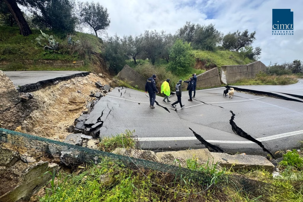
In this context, field surveys represent the first step in understanding the territory in its full complexity, characterized by unstable slopes and drainage networks that are often not immediately visible but play a crucial role.


From rainfall to runoff: reconstructing processes
The objective of the study is to quantitatively reconstruct water behaviour across the territory, from precipitation to surface runoff.
The activities include the statistical characterization of precipitation, also at sub-hourly time scales, within the context of ongoing climate change.
This analysis is complemented by the estimation of flow rates along the minor hydrographic network, a key element for understanding the hydrological response of the area. In parallel, the hydraulic characterization of the study area is carried out, including the entire urban settlement of Niscemi, in order to assess the interactions between water flows, the urban environment, and landslide-affected areas.
The contribution of high-resolution surveys to hydraulic modelling
Field activities are supported by the use of drones, deployed to acquire very high-resolution data for the construction of a digital terrain model of the entire town, to be used for hydraulic modelling purposes.
This tool allows for a detailed representation of local morphology and supports the modelling of preferential flow paths, accumulation areas, as well as erosion and infiltration zones.
The ultimate goal is to intervene in landslide evolution processes by reducing water infiltration from upstream areas, regulating runoff and natural drainage channels, protecting the slope toe from erosion, and stabilizing the channel of the Benefizio stream.


An integrated approach between research and operations
The activities carried out in Niscemi are part of a structured collaboration framework between competence centres and institutions, where scientific knowledge directly supports decision-making processes.
“The field activities in Niscemi, carried out together with the Centre for Civil Protection (CPC) of the University of Florence, represent a fundamental step towards building a robust and integrated knowledge framework of the hydrogeological and hydraulic dynamics affecting the area,” states Luca Ferraris, President of CIMA Research Foundation, present during the field surveys. “The integration of high-resolution surveys, statistical analysis of extreme events within a climate change scenario, and flow modelling provides concrete support to the planning of interventions and residual risk monitoring strategies, strengthening the link between scientific research and operational support to the civil protection system.”
This approach connects advanced analysis with real-world conditions, reinforcing the relationship between applied research and risk management.


Towards residual risk reduction
The data collected and the analyses developed will form the basis for defining targeted interventions and for long-term monitoring of risk conditions.
In a context characterized by increasingly intense and localized phenomena, the ability to understand and model water behaviour becomes a key element in reducing residual risk.
In Niscemi, this process takes shape through an integrated effort in which observation, technology, and modelling converge to transform territorial complexity into concrete tools for risk management.