ASI and CIMA Research Foundation are working together to provide a mapping of the flooded areas in the Marche region, starting from satellite data, by request of the Civil Protection Department. What is often seen as a mere attachment to bulletins, articles and posts, is actually an elaboration of complex data, used for efficient and quick interventions in the affected areas. This is what we do and why
It’s continuously increasing the frequency and the intensity of natural events, like flash-floods affecting small basins where high flows are recorded in a few hours period, such as the one that unfortunately damaged the Marche region. The consequences are devastating, both for the people and the economy (cattle loss, damages to properties and infrastructures etc.). In a scenario like that, the quick availability of the affected area’s synoptic map is a really helpful tool to provide a more efficient and rapid intervention of the authorities in charge. Earth Observation data serve this exact purpose (between others): they represent the most useful source of informations to quickly map the width of the affected area.
The mapping of flood width is fundamental to verify the damage occurred and to organize a first aid. Satellite synthetic-aperture radar (SAR) systems are particularly suitable thanks to the synoptic vision, the ability to work in almost every atmospheric condition both in daylight and night time, and the sensitivity to water microwave radiation, opposed to optic sensors data that provide images during the day and without cloud cover. Thus improving the ability to manage these events, which is essential, especially during the hectic hours of alert and intervention.
Following the flood that hit the province of Ancona, starting from the afternoon of September 15th, 2022, the Italian Department of Civil Protection has activated a mapping service of the flooded areas, starting from satellite data of Earth observation, provided by the CIMA Research Foundation, a competence center for hydrogeological risk. Thanks to the support provided by the ASI-Italian Space Agency, it was possible to acquire images of the affected areas using the potential of the Italian satellites equipped with radar sensors, Cosmo-SkyMed-ASI and Cosmo Second Generation (owned by ASI and the Ministry of Defense) capable of providing images day and night and in any weather condition.
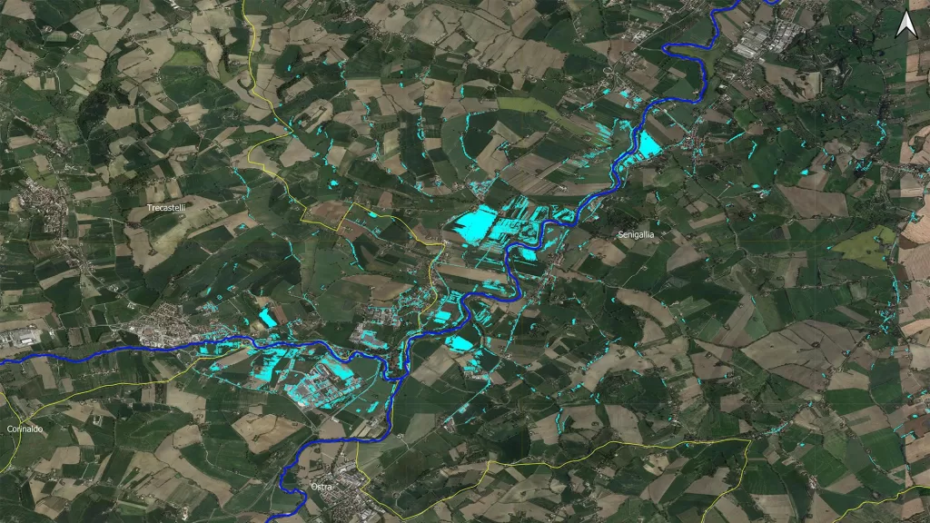
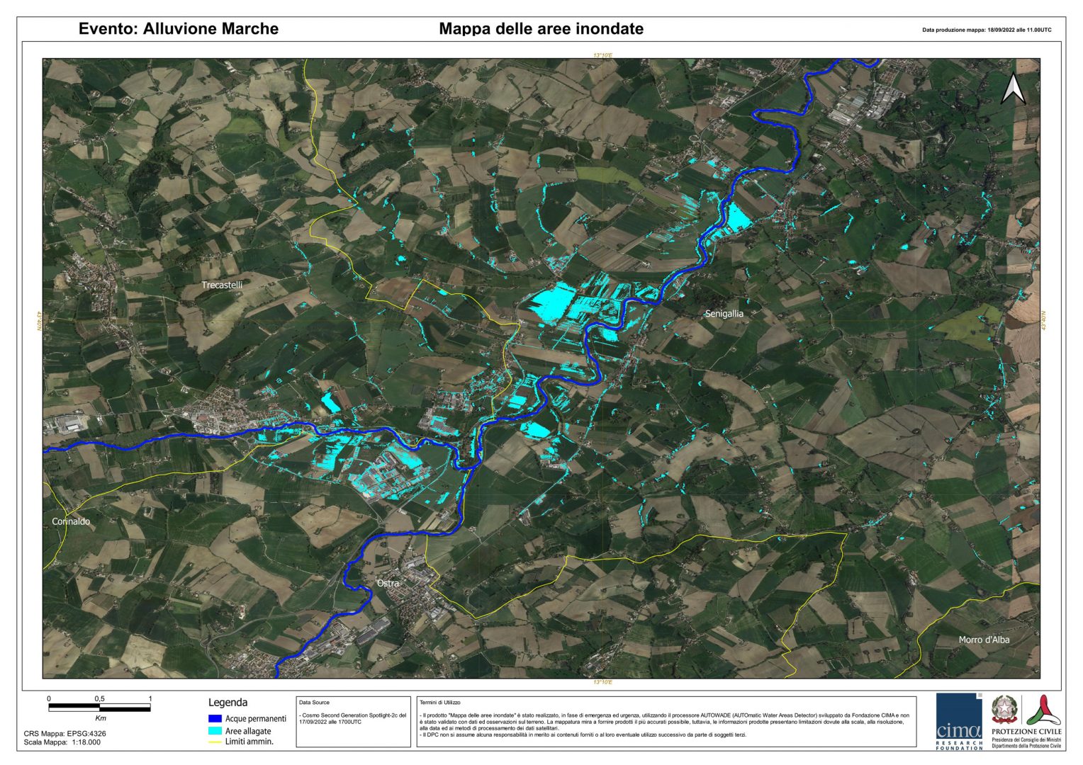
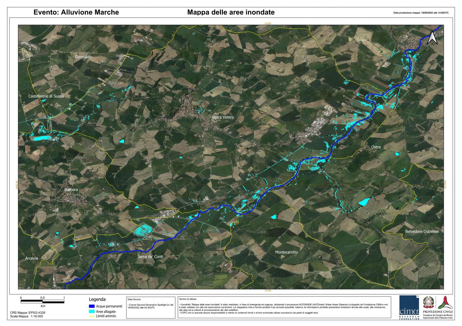
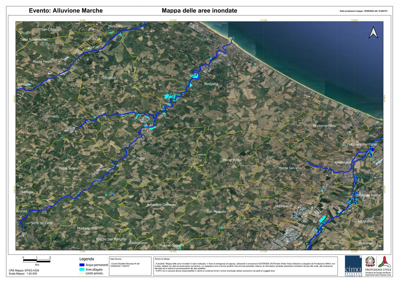
Cosmo-Skymed-ASI observed the area of interest on Friday 16 September, in Scansar Wide Region mode (100kmx100km and 30m resolution), allowing a first global and expeditious assessment of the extension of the remaining flooded areas just a few hours after the end of the event. In the following days, 17 and 18 September, thanks to the performances of the first satellite of the Cosmo Second Generation constellation, it was possible to make 2 high-resolution acquisitions, Spotlight 2-C mode (40kmx20km and resolution of 0.8m) of as many areas immediately upstream of the city of Senigallia (by way of example, below are three maps generated using algorithms developed by fondazione CIMA for the mapping of flooded areas by radar data). These maps, produced in about 5 hours from the availability of the images, show the situation in the area of interest in the different phases of the acquisitions. Blue areas stand for permanent waters, meanwhile light-blue ones represent flooded areas. We can see the consequences of the overflow of Misa river, seen the presence of many light-blue areas near the river itself.
Therefore the constellation COSMO-SkyMed-ASI offers a unique opportunity to obtain radar images that are characterized by a short time of analysis, useful for the mapping of floods development. The system COSMO-SkyMed has been activated many times in these last years due to flood events all over the world and it provided with SAR X band images in the highest resolution possible, useful to floods survey.